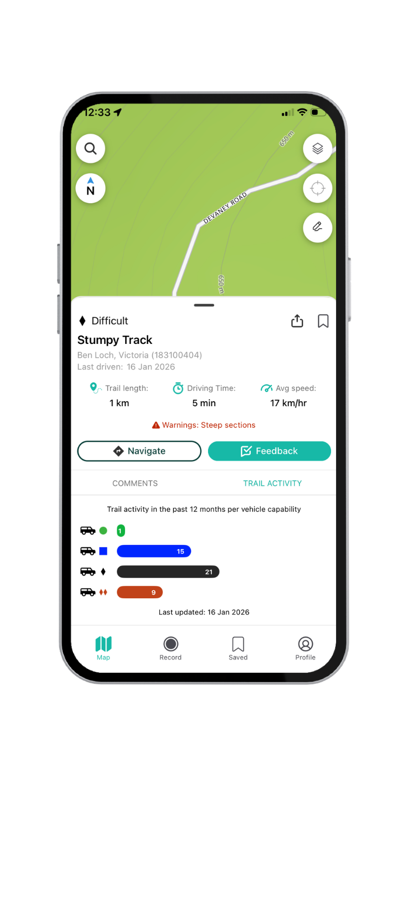

Track stats
Automatically updated track difficulty & stats based on usage, including average time to complete a track, recent traffic by vehicle type, and last update date.
Learn more

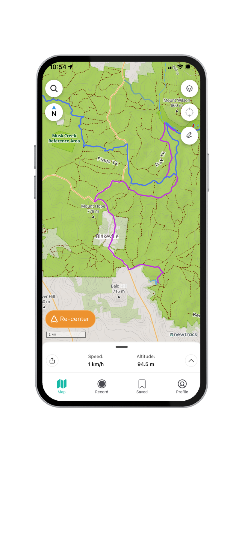
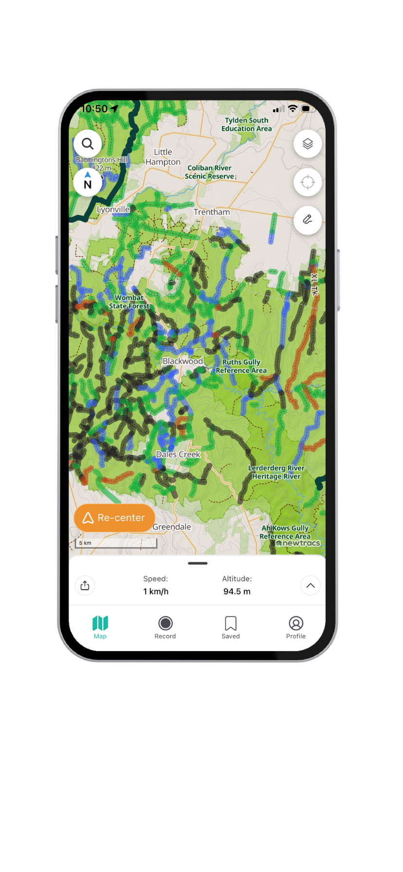
Offline ready topographic 4wd maps with colour coded track difficulty. Explore 20k+ tracks across Australia.
Learn more
Automatically updated track difficulty & stats based on usage, including average time to complete a track, recent traffic by vehicle type, and last update date.
Learn more
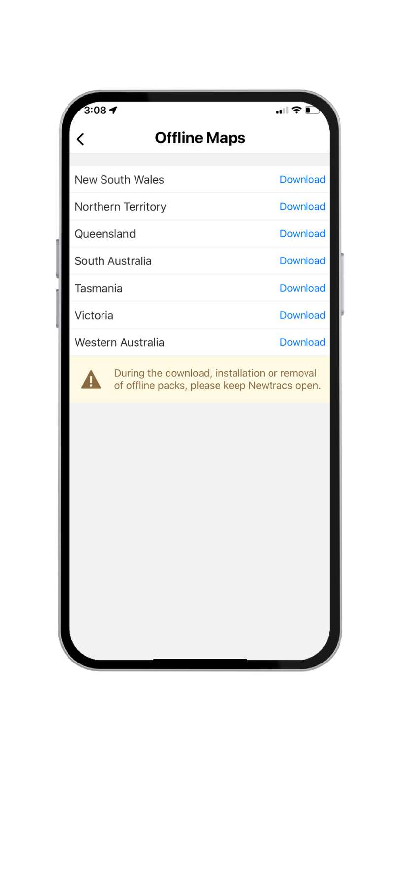
Download crystal clear, smooth loading offline vector maps by state to use when outside mobile reception.
Learn more
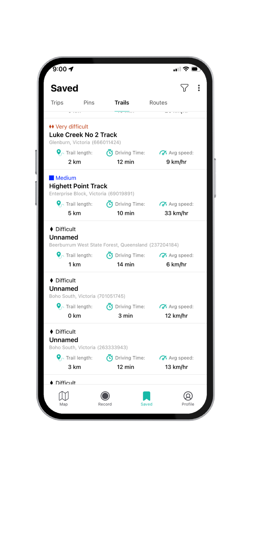
Save awesome 4wd tracks to favourites to visit them later and tick them off your bucket list!
Learn more
Go anywhere with confidence. Newtracs now supports offline routing, so you can plan and navigate without mobile reception. Perfect for remote 4WD tracks and off-grid adventures. Just download your offline map, update the app, enable location permissions and you’re ready to go
Learn more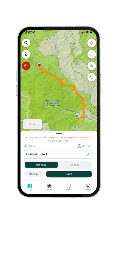

Create a vehicle profile in-app and log your trips to automatically update 4wd track stats and automatically add new 4wd tracks to the live map.
Learn more
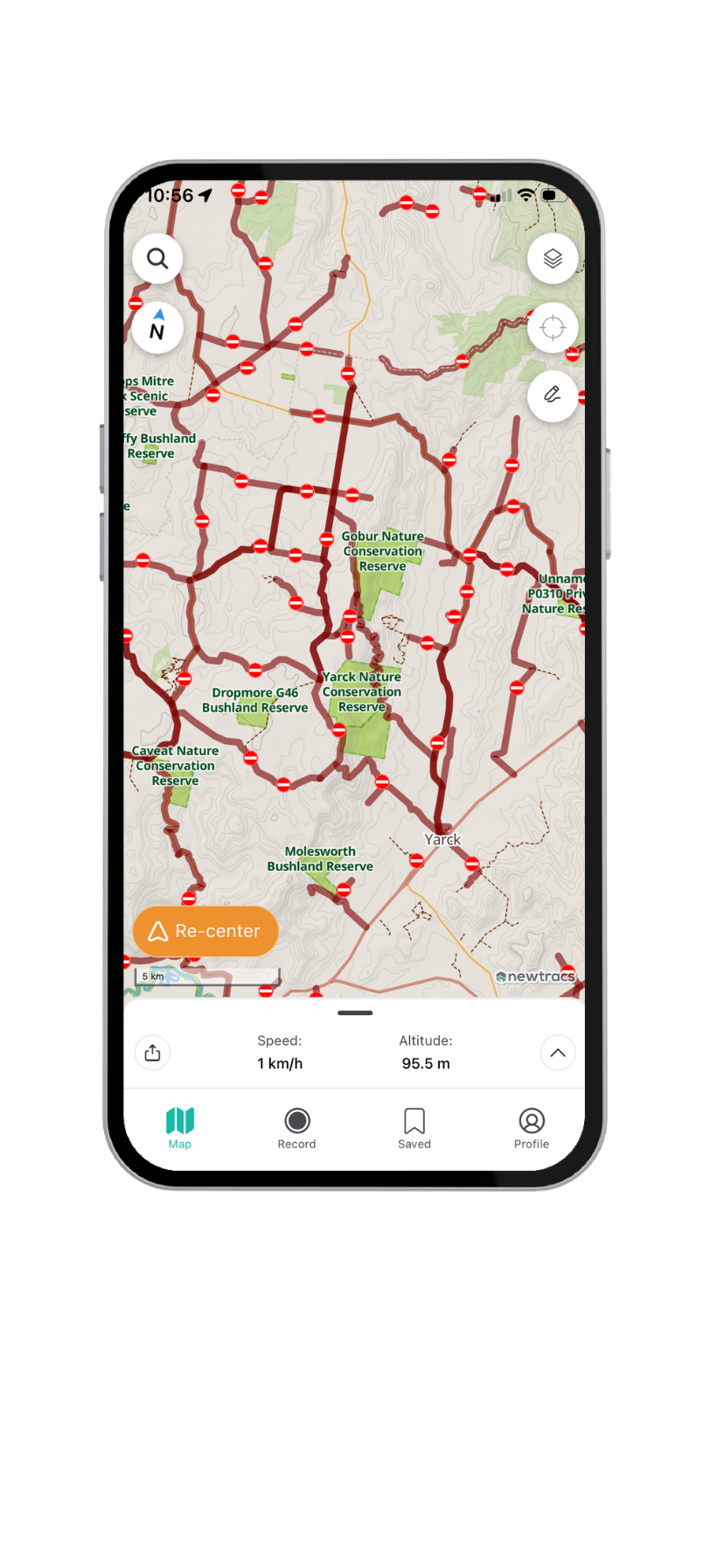
Closed tracks layer updated daily from DELWP and Vic Traffic sources.
Learn moreSwitch The Language